The History of Diamond A Ranch Estates
By Beverly Perrin, John Barinaga, and Helen Bates
2007 and 2008
Edited by Bruce Hoadley - October 11, 2012
2007 and 2008
Edited by Bruce Hoadley - October 11, 2012
Early History of the land
The largest subdivision on Sonoma Mountain is known as "Diamond A," a rural residential community accessed via Grove Street on the South East slope of our beautiful mountain. How did this 1,200 acres of paradise transition from Miwok hunting grounds, to a subdivision of 240 parcels, during the past two centuries? Who were the central characters in this history? Was there any public oversight of the subdivision process, or was it driven primarily by private interests? Could it happen again in the 21st century? These are the questions addressed in this brief history.In 1769, when the Miwok Indians, of the Sonoma Coast, first came in contact with Europeans, they numbered about 1,500. Their hunting grounds included all of Sonoma Mountain. By 1930 the Miwok Indians numbered only about 500. The mountain had been divided into parcels, and passed through various owners. However, the coyotes, who the Miwok Indians believed to be their ancestors and Creator God, still prowl the mountain. They howl near the ridge line at night, ignoring the artificial boundaries that have been placed on the land.
From 1834 to 1857, the southern portion of Sonoma Mountain, from the Petaluma River to Sonoma Creek , was part of "Rancho Petaluma." According to the Petaluma State Historic Park website, Rancho Petaluma was a 44,000 acre land grant to General Mariano Vallejo in 1834. It was later extended to more than 66,000 acres. The Rancho stretched eastward from Petaluma Creek, over the hills, and down to Sonoma Creek, including all the land that lay between those two waterways, from the edge of San Francisco Bay to Glen Ellen. In 1857, Vallejo decided to sell his Petaluma Adobe and some of the land around it. By 1866, when the Rowe survey of the western portion of Rancho Petaluma was recorded, the 66,000 acres had been split into many parcels - some sold by General Vallejo, others taken by Anglo squatters.
The 1897 Illustrated Atlas shows the unmistakable shape of what was to become the Diamond A Ranch, labeled "Henry A. Hardin 1,240 acres" (Hardin Ranch map) Henry Andrew Hardin was born in Kentucky in 1833. In 1852, he joined an ox-team train, which traveled from Missouri to Sonoma County. He bought and sold various parcels before buying the 1,240 acre Ranch in 1877 from Edward Halloran. Hardin owned this Ranch until his death in 1920. Three of his daughters sold the Ranch to the Felder family in 1934. The Felder family owned the Ranch for a few years, and then sold it to the Berrien Anderson family in 1938.
The Early Development of Diamond A
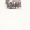
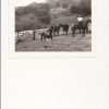
In 1961, Anderson sold the ranch to the developers, Thomas Burke & Jack Fisher, for $400,000. Jack Fisher lived at 3775 Burke Place, in Unit #1 of the Diamond A Ranch Estates, until his death on March 12, 2003.In 1965, the Preliminary Master Plan for the Diamond A Ranch Estates divided 1,220 acres into 482 home sites of 1.5 to 2.5 acres each. The plan included extensive recreation areas along Carriger Creek and on the steep wooded slopes. This Preliminary Master Plan showed Units 1 through 5, much as they were later developed. Of the 482 lots, 290 were not completed as shown. Instead, they were later consolidated into larger lots. T. E. Burke recorded the declarations for Unit 1 on 11/8/1962, and Unit 2 on 8/23/1962. They were recorded in the name of Kenleigh Homes Inc. Unit 1 had 25 lots, and Unit 2 had 28 lots. The original broker for the development was Robert Garlick. According to Robert Garlick's son, Dave, the Plans called for a multiphase development, which would include 500 to 600 lots ranging in size from 1.5 acres to 3 acres. Phase one included excavation and construction of the main road, leading from the old Van Hoosear Ranch, at the base of the Mountain, to the Diamond A entrance. A new road construction method was used. It allowed for a steep but straight approach up the hill. The old one-lane road was not steep, full of turns, and took about 20 minutes to navigate. The first two phases of the project went relatively well. Lots typically sold for $6,000 to $8,000. Many Bay Area residents fell in love with the magnificent views and beautiful hillsides. Live Oak, White Oak, and Pepperwood were in abundance. The golden hills turned purple and orange each spring, as lupine and poppies dominated the fields. The exclusive realtor was Bob Garlick, who worked out of the old ranch house.
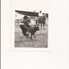
After awhile, the undeveloped property changed hands. Two Stanford graduates fell in love with the property. They made an offer that Fisher and Burke could not turn down. These two developers were very much into promoting and marketing. San Francisco radio stations encouraged Bay Area residents to visit the Ranch. The visits included a tour in a Rolls Royce Jeep, conducted by “Trail Boss Bob†Garlick. Phase Three was started, and looked promising for the development.
A Change of Direction
Disaster hit in the late 1960’s. The owner of one on the lots, located slightly below the old ranch house, undertook significant grading without permits. With the first winter rain, a landslide from this area caused significant damage to the road below. Red flags went up at the county. A moratorium on future building was put in place, until geologic and landslide studies were completed. This study concluded that 27 lots were high-risk , 65 were low risk, and 95 lots were intermediate risk. As a result, the county tightened foundation requirements. The process took a couple of years. This delay caused the developers to lose the Ranch through foreclosure. During those bleak years, the developers were trying to sell the remaining acres in one block. One prospective buyer had big plans to develop a world-class golf course. Trail Boss Bob, in his Jeep, took the golf course developer to the highest point on the Ranch, to best view the undeveloped areas. The jeep was parked at the top of the hill. As they got out, the stick shift was accidentally knocked into neutral. Both men watched as the Jeep went down the hill and crashed into an oak tree. The walk out took about two hours. That was the end of the golf course plans. The remaining acres were finally sold to the highest bidder, at the steps of the county courthouse. From that point on, the development of the remaining acres took a different direction. The future phases included much larger lots ranging from 10 to 40 acres.On February 18,1965, the declaration for Unit 3, with 56 lots, was filed in the name of Fisher and Burke, Inc. by T. E. Burke, President and Jack Fisher, Secretary Treasurer. On October 29, 1965, William J. Troy, President of the Sonoma Land Corporation, filed the declaration for Unit 4, with 4 lots. On December 29, 1966, the Sonoma Development Corporation President, William J Troy, filed the declaration for Unit No 5, with 71 lots. On December 23, 1976, the Piombo Corporation filed a declaration to divide the northeast sector of the Ranch into lots 1 through 16, to be named Diamond A Ranches.
As a result of all these declarations, the old Anderson Ranch evolved into two subdivisions: [1] The Diamond A Ranch Estates, and [2] The Diamond A Ranches. Over time, the leftover pieces were further subdivided and some were built. In a 1999 count, the lots on the old 1,221-acre Ranch were: [1] Diamond A Ranch Estates subdivision with 190 lots (1962-1966), [2] Diamond A Ranches subdivision with16 lots (1976), and [3] The balance divided into 34 lots. There are a total of 240 lots. This is about half of the 482 lots in the 1965 Preliminary Master Plan. Out of the 240 lots in the 1999 count, 188 had been built, and 52 had not been built. Several lots have been built since 1999. Our 2007 telephone directory lists 199 households. Note, in some cases, there is more than one household per lot.
Future Development?
From this history it seems that there was little planning or oversight by the County until Mother Nature intervened in the form of a landslide. As a result of these interventions, the original developers lost the land, and Sonoma Mountain was spared from a much denser development on its eastern flank. Could a subdivision like Diamond A happen again? Probably not. Sonoma Mountain Preservation helped enact Guidelines for Development in 1998. These guidelines are now closely monitored by Sonoma County and Sonoma Mountain Preservation.References
The research for this article was done by John Barinaga, Marilyn Goode, Beverly Perrin, and Jack Nisson. They used the following sources:- Sonoma Mountain Preservation Newsletter - September, 2008
- Wikipedia
- Illustrated Atlas of Sonoma County, 1897, Reynolds & Proctor, Santa Rosa
- An Illustrated History of Sonoma Co. CA, Lewis Publishing Company
- History of Sonoma Co. CA, 1911, Tom Gregory, Historic Record Co. Los Angeles
- Sonoma Index Tribune
- Diamond A Property Owners' Association
- Property transfer dates sourced from the Sonoma County Assessor’s Office